Pentagon Reveals How the Defense Mapping Agency Helped Win the First Iraq War
Mapping experts worked around the clock to deliver battlefield intelligence during Operation Desert Storm
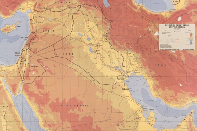
The U.S. Department of War on Wednesday detailed how the Defense Mapping Agency supported coalition forces during the 1991 Gulf War by rapidly delivering updated maps, satellite imagery and maritime charts for combat operations.
On Feb. 24, 1991, coalition troops launched the ground phase of Operation Desert Storm to liberate Kuwait from Iraqi occupation. By the end of the first day, 10,000 Iraqi troops had been captured and a U.S. air base was operating inside Iraq. Within 100 hours, Iraq agreed to a ceasefire.
Before the war, most maps of Kuwait, eastern Saudi Arabia and southern Iraq were based on British colonial-era surveys. Rapid development in the region had made many of them outdated, limiting their military use. In response, the Defense Mapping Agency redirected space-based imagery assets and began remapping the region.
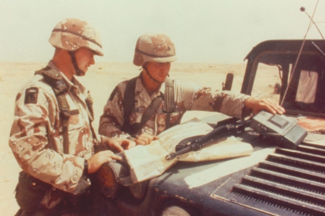
One key product was the 1:50,000-scale topographic line map used by ground forces. Production time was cut from six months to six weeks to meet operational demand.
The agency also provided geographic data used to guide precision munitions, which were widely employed during the conflict. In earlier wars such as the Vietnam War, commanders relied largely on broad bombing campaigns. During the Gulf War, improved targeting data allowed strikes to be carried out with greater accuracy.
Naval forces also depended on the agency’s charts. Before the conflict, there were concerns about operating carrier battle groups in the confined waters of the Persian Gulf and Red Sea. Marine charts enabled deployments closer to the Kuwait Theater and supported amphibious operations, mine countermeasures and special missions.
When Iraqi leader Saddam Hussein sabotaged an oil tanker facility, hydrographic charts were used to track the movement of the resulting oil slick, which threatened both operations and the environment. About 90% of equipment and supplies entering the Gulf theater arrived by sea, relying on maritime mapping products.
During the war, the agency’s civilian and military logistics team prepared and shipped more than 44 million map sheets without losing a single shipment. In total, more than 1,900 unique maps and charts were produced and over 54 million paper copies printed. In 2018, the team was inducted into the Geospatial-Intelligence Hall of Fame.
Dutch Firm to Supply Universal Drone Control Software to Netherlands MoD

Will Indian Air Force buy an Indigenous High Altitude Pseudo Satellite?
Russia’s “Magic Bullet” Against FPV Drones?
U.K. Army, Navy Test Low-cost Attack Drone Developed by BAE Systems Subsidiary...

One Month Since U.S., Israeli War Against Iran: Who Is Gaining?
One month after the United States and Israel launched coordinated strikes on Iran on February 28 the conflict has expanded...
Modern Tank Showdown: T-90MS, Leopard 2A7, M1E3 Abrams Compared
Main Battle Tanks (MBTs) have shown their mettle in recent conflicts such as in Ukraine despite being increasingly vulnerable to...
European Nations Prioritizing Europe-made IRIS-T & SAMP-T over American Patriot Air Defense Systems?
European nations looking to procure new air defense systems appear to be giving the much-vaunted American Patriot a miss in...

Russian T-90MS Crew Discuss Future Upgrades
Defense Mirror spoke with the crew members of the Russian T-90MS main battle tank, produced by UralVagonZavod

China's Mass-produced J-35A Aircraft Set to Disrupt Global Stealth Fighter Market
China is aiming to disrupt the global stealth fighter market by mass-producing its fifth-generation J-35A at a pace comparable to...

The Future of Combat: Miniaturized Laser Weapons Set to Replace Bullets and Missiles
Lasers may soon replace bullets, and drones could disable enemy UAVs with beams of light instead of missiles