
India Relies On Russian GLONASS GPS For BrahMos Launch
India’s latest test launch of the sea-based BrahMos supersonic cruise missile relied on the Russian GPS-GLONASS technology to guide it to its target.
The GLONASS technology was added to the existing doppler-inertial platform, allowing the missile to be updated with advanced satellite navigation systems from Russia's Kh-555 and Kh-101 strategic long-range cruise missiles.
This is perhaps the first international application of the Russian GPS-GLONASS precision navigation system for a missile launch and further underscores the close defence relationship between India and Russia.
In 2011, Russia offered India services for transmitting high-precision signals through GLONASS for the guidance of Indian ballistic missiles. Russia reportedly offered New Delhi the technology knowing that the U.S will most likely not offer its GPS codes for high-precision signal transmissions and that Indian scientists would take too much time to develop such a system.
“After acquiring the target, the missile flies toward it with high precision, constantly receiving updated coordinates from a satellite navigation system, a senior Russian official was quoted as saying.
Meanwhile in 2012, Russia offered India joint participation in development of its GLONASS satellite navigation system on an equal basis.
“We have offered our Indian counterparts not only use of the GLONASS system but also participation in upgrading it. We practically see it as a joint effort. I think our Indian counterparts will be interested in it,” a senior Russian space agency official was quoted as saying
Glonass - the Global Navigation Satellite System - is the Russian equivalent of the U.S. Global Positioning System, or GPS, and is designed for both military and civilian uses. Both systems enable users to determine their positions to within a few meters.
At present, there are 31 GLONASS satellites in orbit, 23 of which are in operation, in reserve, or still being tested. Another fail could delay the launch of the system by several more years, according to reports.
GLONASS is only the second worldwide navigation system to be fully operational following the U.S. GPS. The European Union is currently developing a global system planned to be operational by 2014.
In all there are five navigation satellites being developed or in place around the world including; Galileo, being developed by the European Union, GLONASS, managed by Russia, COMPASS, by China, IRNSS by India and QZSS in Japan. India’s navigation system covering the Northern Indian Ocean is expected to be operational this year and China plans to launch its own system by the end of 2020.

Portugal Orders Sixth KC-390 Aircraft Contract
Korea Aerospace Unveils Design of New Electronic Warfare Aircraft
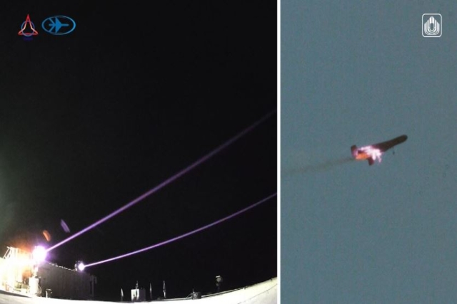
Israel Completes Iron Beam Laser Weapon Development, IDF Delivery Imminent

Canada Receives First CT-102B Astra II Training Aircraft

China's Mass-produced J-35A Aircraft Set to Disrupt Global Stealth Fighter Market
China is aiming to disrupt the global stealth fighter market by mass-producing its fifth-generation J-35A at a pace comparable to...

The Future of Combat: Miniaturized Laser Weapons Set to Replace Bullets and Missiles
Lasers may soon replace bullets, and drones could disable enemy UAVs with beams of light instead of missiles

Four-legged Robots Vs. Military Dogs
Four legged robots that resemble dogs are increasingly being seen in war zones and exercises for functions such as reconnaissance...

Lockheed Martin Faces Billions in F-35 Cuts Under U.S. Policy Shift
Americas policy of controlling F-35 usage, spares, and maintenance—combined with President Donald Trumps threats of trade wars with Europe, halted...

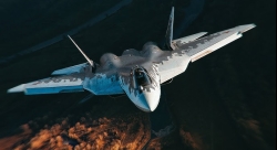
Russian Su-57 and Chinese J-20 as Alternatives to the American F-35 Stealth Fighter
As the Russian Su-57 stealth fighter jet enters serial production, the debate over how it stacks up against the American...